Over the past decade, solar farms have become a common feature of the British landscape with thousands in operation around the country.
Solar farms use photovoltaic (PV) panels to generate energy from daylight and distribute it through the existing electricity grid to homes and businesses in the local area and nationwide.
The site is located away from the settlement of Tamworth. The height of the entire development is expected to be no more than 3m and development will be positioned within existing fields so that hedges and trees will not need to be removed.
Solar farms make very little noise in operation and will not be audible outside of the development itself. At the end of its 40 year operational life, the equipment will be removed and the entire site will be restored as per the legal obligation to the landowner.
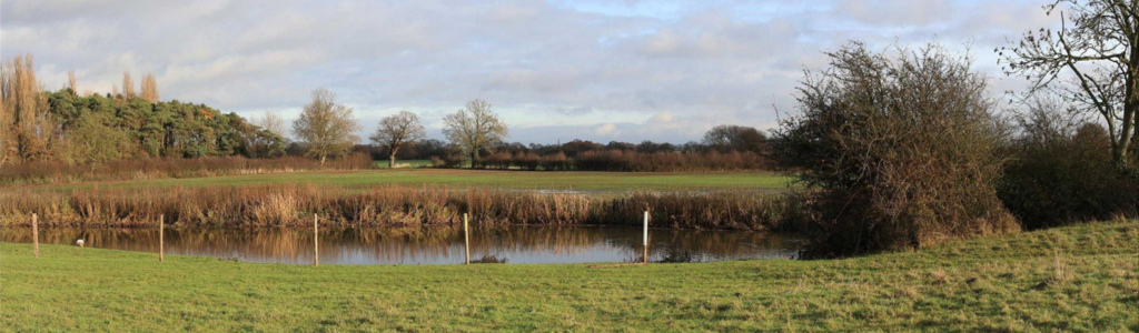
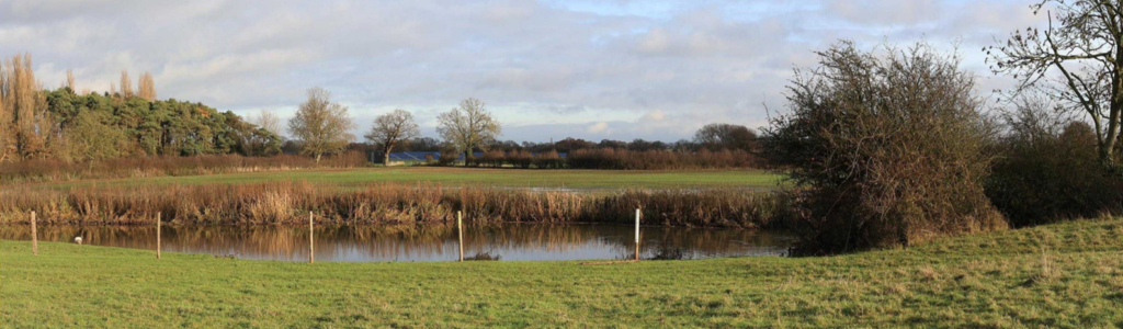
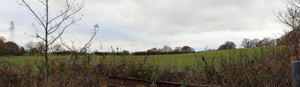
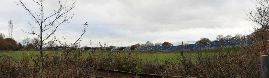
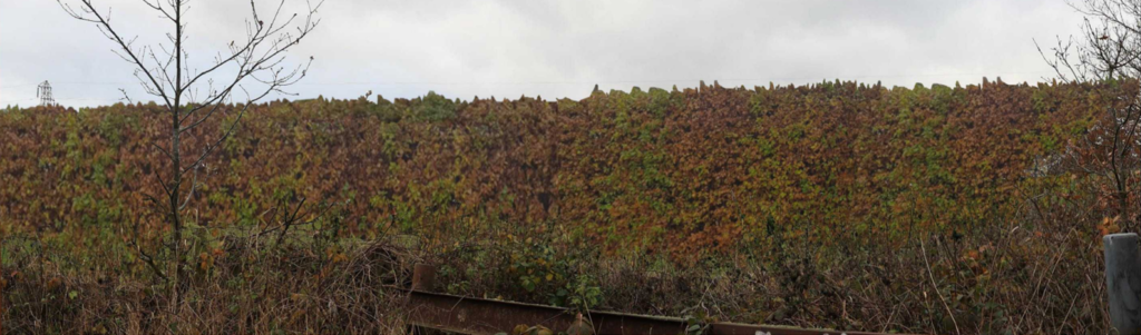
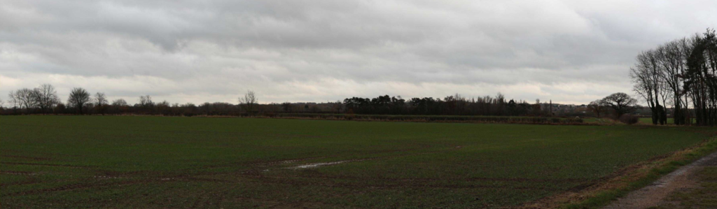
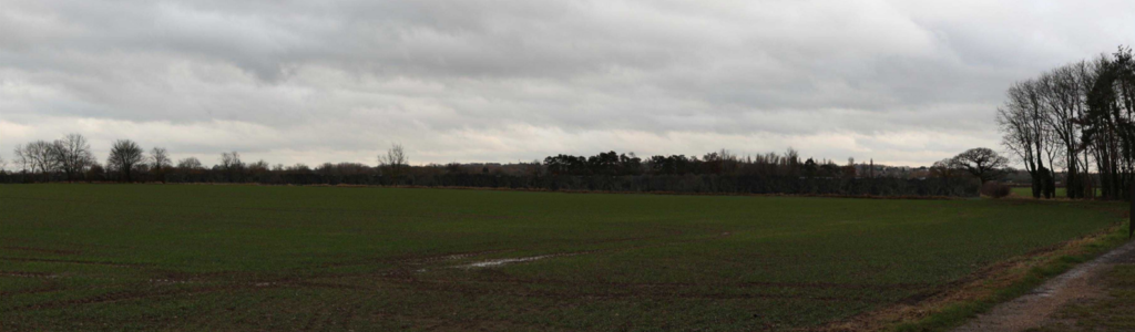
The computer-generated images below illustrate what it will look like from viewpoints around the site:
View from the public right of way west of the site today, 1 day post installation and 10 years post installation:


Traffic
Once operational, solar farms generate almost no traffic. Visits for maintenance are required every few months. The construction process is rapid, lasting only a few months.
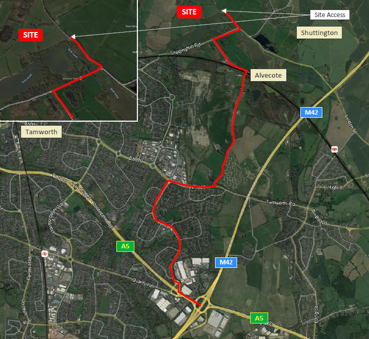
Access into the site by construction vehicles will be taken from Shuttington Road and will turn into Laundry lane located South/ South East of the proposed development. This will also be used for operational purposes. Construction noise will be kept to a minimum, with operations restricted to normal working hours.
Construction Traffic Plan
Planning Application Documents
REPD have commissioned a comprehensive set of surveys to help determine both the site area and layout, so that any potential impacts can be minimised whilst also identifying opportunities to enhance the proposal. These will be presented in an Environmental Statement to accompany the application. In summary:
- Landscape and visual
impact assessment
This has helped determine the maximum height of the development, the position of equipment, and to assess the effect of the development on the surrounding area.
- Heritage and archaeology assessment
These have considered listed buildings, scheduled monuments and conservation areas within in the area. A geophysical survey has also been undertaken to help assess the potential for archaeological features below the ground.
- Transport and Access Statement
This has confirmed the most suitable access and route for construction traffic in order to avoid traffic entering nearby towns and villages. The construction period is expected to last no more than 25 weeks.
- Arboriculture survey This has identified important trees within and around the site. The findings of this survey will be used to ensure that trees are protected within the proposed layout.
- Flood risk assessment and surface water management survey
The site is located within a mixture of Flood Zone 1, 2 and 3. The Proposed development would be operated with minimal risk from flooding, would not increase flood risk elsewhere.
- Preliminary ecological appraisal
This has identified the statutory ecological designations around the site, assessed wildlife habitats on and near the site and has recommended measures to protect and enhance biodiversity.
- Analysis of agricultural land grade
No agricultural land will be lost. The site is currently a mixture of arable and grassland. Sheep can continue to graze under and around the solar panels during operation, providing a dual benefit of agriculture and energy generation. An agricultural land classification survey has confirmed that most of the land is lower quality for farming purposes.
Further to this, we are due to be carrying out the below additional surveys. These will be updated accordingly:
- Breeding Bird Survey
- Bat Tree Roost Assessment
- Glint and Glare
- Great Crested Newt Presence Absence